OGC Web Services
The Open Geospatial Consortium, Inc (OGC) is a standards organization leading the development of geospatial and location based services. The OGC has adopted a number of specifications, some of which are used by the IEM. This page lists these services.
Some items of note:
- Not all TMS services are documented here as some of them are not directly usuable without loading up parameters into the layer name.
- All of these services are available via https:// connections.
- There are four DNS aliases for the website to allow web browers to make
many simultaneous requests against these services.
- mesonet1.agron.iastate.edu
- mesonet2.agron.iastate.edu
- mesonet3.agron.iastate.edu
- www.mesonet.agron.iastate.edu
Tile Map Service (TMS)
The IEM has two base endpoints for its TMS services. They are partitioned by their cache header settings.
| Endpoint | Cache Header |
|---|---|
| /c/tile.py/1.0.0 | 14 days |
| /cache/tile.py/1.0.0 | 5 minutes |
The IEM also runs a customized version of TileCache that allows some argument loading into the service layer name. For example, including timestamp information in the layer name.
Here are working examples using IEM TMS services within various Javascript libraries.
ESRI JS API
Here is an example using the ESRI JS API. This was contributed by Derek Swingley.
Google Maps
Here is an example for Google Maps v3.
/c/tile.py/1.0.0/
and /cache/tile.py/1.0.0/Why both? If you are using stable layer names (ie with a
umabiguous timestamp), you likely want to use the /c/ service so to
have better client side caching.
| Layer Name | Description | Legend |
|---|---|---|
| Template: ridge::XXX-XXX-0 | Latest individual RADAR XXX data for product XXX more info | |
| Template: ridge::XXX-XXX-YYYYMMDDHHMI | Archived individual RADAR XXX data for product XXX more info |
/c/tile.py/1.0.0/| Layer Name | Description | Legend |
|---|---|---|
| depmask | Daily Erosion Project mask for HUC12s that are not modelled. | |
| uscounties | US County Borders | |
| usstates | US State Borders |
/cache/tile.py/1.0.0/| Layer Name | Description | Legend |
|---|---|---|
| GOES Satellite Imagery | ||
| goes-vis-1km
goes-ir-4km goes-wv-4km conus-goes-vis-1km conus-goes-ir-4km conus-goes-wv-4km |
These are legacy service names that all pointing at the same GOES East products. Channel 02 for visible, channel 13 for IR, and channel 09 for WV. The conus here is poorly named as it is only just GOES east. These layers update in near realtime and you can find JSON metadata files for each channel that denote the valid time. | more info |
| Template: goes_bird_sector_chchannel Example: goes_east_conus_ch02 |
Current GOES R/S Imagery. Where: bird is "east" or "west" sector is "fulldisk", "alaska" (west only), "conus", "mesoscale-1", "mesoscale-2", "puertorico" (east only) channel is two-digit, zero padded 01-16 |
more info |
| HRRR Weather Forecast Model | ||
| Template: hrrr::REFD-FXXXX-0 | Latest HRRR Reflectivity Forecasts, FXXXX is the forecast minute more info | |
| Template: hrrr::REFD-FXXXX-YYYYMMDDHHMI | Archived HRRR Reflectivity Forecasts, FXXXX is the forecast minute more info | |
| Template: hrrr::REFP-FXXXX-0 | Latest HRRR Reflectivity (with Precip Type) Forecasts, FXXXX is the forecast minute more info | |
| Template: hrrr::REFP-FXXXX-YYYYMMDDHHMI | Archived HRRR Reflectivity (with Precip Type) Forecasts, FXXXX is the forecast minute more info | |
| NEXRAD Mosaics | ||
| nexrad-n0q | NEXRAD Base Reflectivity current | |
| nexrad-n0q-mXXm | ... where XX is a zero padded number modulo 5 between
05 and 55 minutes old. | |
| nexrad-eet | NEXRAD Echo Tops EET current | |
| nexrad-eet-mXXm | ... where XX is a zero padded number module 5 between
05 and 55 minutes old. | |
| MRMS Products | ||
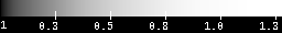
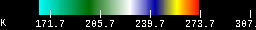
| q2-n1p | MRMS 1 Hour Precipitation | 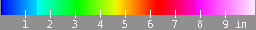 |
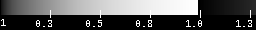
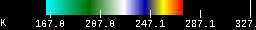
| q2-p24h | MRMS 24 Hour Precipitation | 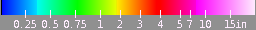 |
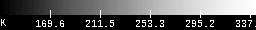
| q2-p48h | MRMS 48 Hour Precipitation | |
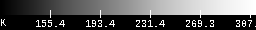
| q2-p72h | MRMS 72 Hour Precipitation | |
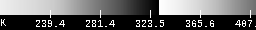
| q2-hsr | MRMS Hybrid-Scan Reflectivity Composite (SeamlessHSR). | 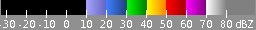 |
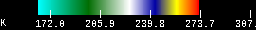
| mrms::a2m-YYYYMMDDHHMI | Archived MRMS PrecipRate product. An archived raster should be available for each minute modulo 2 since early 2015. | 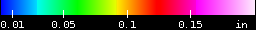 |
| mrms::lcref-YYYYMMDDHHMI | Archived MRMS SeamlessHSR product. An archived raster should be available for each minute modulo 2 since early 2015. | |
| mrms::p{1,24,48,72}h-YYYYMMDDHHMI | Archived MRMS precipitation estimate over given backwards looking hourly interval. Note that the 1 hourly value is not zero padded with the URI. Rasters are only available at the top of each hour since early 2015! | See Above for Ramps |
Web Map Service (WMS)
A WMS defines a protocol for web based retrieval of geodata in raster map format. If you are interested in the capabilities XML file, simply add "VERSION=1.1.1&REQUEST=GetCapabilities&SERVICE=WMS&" to the URI string.
- Iowa Precipitation
https://mesonet.agron.iastate.edu/cgi-bin/wms/iowa/rainfall.cgi? - MRMS Q3 Precipitation (Missing data is grey)
https://mesonet.agron.iastate.edu/cgi-bin/wms/us/mrms.cgi?
Layer: mrms_p72h 72 Hour Precipitation
Layer: mrms_p48h 48 Hour Precipitation
Layer: mrms_p24h 24 Hour Precipitation
Layer: mrms_p1h One Hour Precipitation - MRMS Q3 Precipitation (Missing data is transparent)
https://mesonet.agron.iastate.edu/cgi-bin/wms/us/mrms_nn.cgi?
Layer: mrms_p72h 72 Hour Precipitation
Layer: mrms_p48h 48 Hour Precipitation
Layer: mrms_p24h 24 Hour Precipitation
Layer: mrms_p1h One Hour Precipitation
- GOES East Imagery (All Sectors, All 16 Channels)
https://mesonet.agron.iastate.edu/cgi-bin/wms/goes_east.cgi?
Layer Template: sector_chchannel ie conus_ch02 - GOES West Imagery (All Sectors, All 16 Channels)
https://mesonet.agron.iastate.edu/cgi-bin/wms/goes_west.cgi?
Layer Template: sector_chchannel
Channel 1
Channel 2

Channel 3

Channel 4
Channel 5

Channel 6

Channel 7
Channel 8
Channel 9
Channel 10
Channel 11
Channel 12
Channel 13

Channel 14

Channel 15

Channel 16
- CONUS NEXRAD Base Reflectivity (n0q)
https://mesonet.agron.iastate.edu/cgi-bin/wms/nexrad/n0q.cgi? - Historical CONUS NEXRAD Base Reflectivity [WMS-T] (n0q)
https://mesonet.agron.iastate.edu/cgi-bin/wms/nexrad/n0q-t.cgi? - Historical CONUS NEXRAD Base Reflectivity [WMS-T] (n0r)
https://mesonet.agron.iastate.edu/cgi-bin/wms/nexrad/n0r-t.cgi? - CONUS NEXRAD 8-bit Net Echo Tops (eet)
https://mesonet.agron.iastate.edu/cgi-bin/wms/nexrad/eet.cgi? - CONUS NEXRAD 1 Hour Precipitation (daa)
https://mesonet.agron.iastate.edu/cgi-bin/wms/nexrad/daa.cgi? - CONUS NEXRAD Net Echo Tops (net)
https://mesonet.agron.iastate.edu/cgi-bin/wms/nexrad/net.cgi? - CONUS NEXRAD Storm Total Precipitation (dta)
https://mesonet.agron.iastate.edu/cgi-bin/wms/nexrad/dta.cgi? - RIDGE Single NEXRAD Imagery
https://mesonet.agron.iastate.edu/cgi-bin/wms/nexrad/ridge.cgi?sector=XXX&prod=XXX&
You also need to provide two CGI variables for the NEXRAD identifier and level III product you want. For example, sector=DMX&prod=N0Q
Layer: single Most recent image for the given RADAR identifier and Level III product. A simple JSON metadata file exists for each RADAR and Level III product combination, for example DMX N0Q.
Layer: single-archive This allows request of a specific volume scan time from IEM's archive of imagery. You need to specify the prod and sector like with the "single" layer, but also need to include a year, month, day and time. All of these values are in UTC. Here's an example request that gets NEXRAD RTX N0Q product for 27 Jan 2015 at 23:03 UTC. You must know the volume scan times prior to making the request. There are JSON services that can help you out. Unfortunately, this service does not support WMS-T due to complications with how I serve this information out, sorry. - NWS Current Warnings
https://mesonet.agron.iastate.edu/cgi-bin/wms/us/wwa.cgi? - Iowa Rainfall Estimates
https://mesonet.agron.iastate.edu/cgi-bin/wms/iowa/rainfall.cgi? - Iowa Winter Road Conditions
https://mesonet.agron.iastate.edu/cgi-bin/wms/iowa/roadcond.cgi?
Layer: roadcond-noninterstate Non Interstate Road Conditions
Layer: roadcond-interstate Interstate Road Conditions
Web Feature Service (WFS)
A WFS is a service that provides geodata as simple features in Geography Markup Language (GML).
- National Weather Service Warnings Current
https://mesonet.agron.iastate.edu/wfs/ww.php? - National Weather Service Warnings Archive For UTC Date (since 11 Jul 2002)
https://mesonet.agron.iastate.edu/wfs/ww.php?date=YYYY-MM-DD& - National Weather Service Warnings Archive At Given UTC Time(since 11 Jul 2002)
https://mesonet.agron.iastate.edu/wfs/ww.php?date=YYYY-MM-DD&time=HH:MI&