Temperature Key:

IEM Freeze
This application uses the
IEM RadMap API to generate
the image you see above. You could place the above image on your webpage by
right-clicking the image above and select "Copy Image URL" and then use that
as your image source on your webpage.
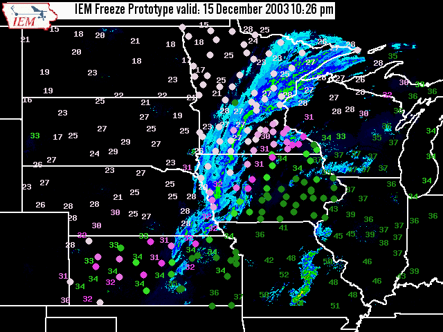
IEM Freeze lets you quickly evaluate air
and pavement temperatures, along with concurrent radar observations
of precipitation:
- Pavement temperatures are indicated by color-coded dots.
- Air temperatures are given by numerical values (also color-coded).
- Current Composite RADAR also is overlain on each plot.
This historical plot shows how IEM Freeze looks when the winter weather gets interesting.
Your feedback is needed! Please let me know how you would like this application to behave.