IEM Daily Feature
Friday, 13 December 2024
Friday, 13 December 2024
Precip Type Forecast
Posted: 13 Dec 2024 05:30 AM
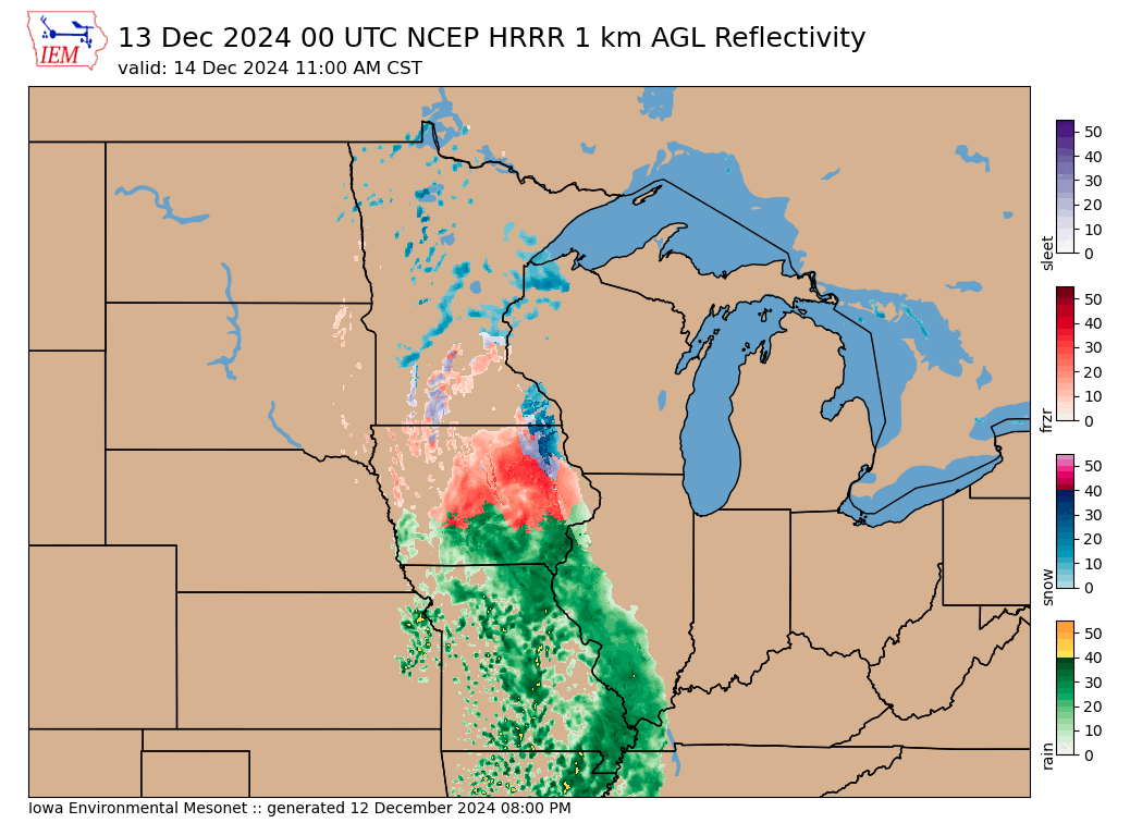
The most significant winter storm of the season is set to impact the state later today and through Saturday. Of most concern is the accumulation of damaging amounts of freezing rain causing power outages and dangerous travel conditions. Forecasting such events is often tricky as near surface air temperatures may be close to freezing and liquid water freezing near the surface actually releases heat and will warm air temperatures some. One of the main weather forecast models that help meteorologists during these events is the High Resolution Rapid Refresh (HRRR). The HRRR model attempts to forecast not only rainfall, but the type of precipitation hitting the ground. It is also popular for producing a pseudo-RADAR looking output field that resembles reflectivity. Anyway, the IEM attempts to process all of this information and has recently started generating a precip type colored reflectivity plot. The featured plot is a forecast for 11 AM on Saturday. This forecast depicts an area to the south warm enough to support rain (green colors) and then freezing rain with colder temperatures north of about Interstate-80 (oranges) with even colder temperatures to the north supporting snow. Please use care traveling Friday evening and into Sunday morning!
Voting:
Good = 23
Bad = 0
Tags: hrrr
Voting:
Good = 23
Bad = 0
Tags: hrrr