IEM Daily Feature
Thursday, 25 January 2024
Thursday, 25 January 2024
Minimal Temp Variability
Posted: 25 Jan 2024 05:30 AM
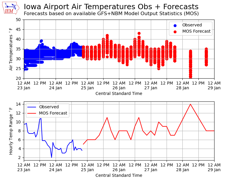
Drizzle, low clouds, fog, and melting snow have put a significant damper on much of any temperature variability over Iowa. On Tuesday and among the airport weather stations, the range between the warmest high (38°F) and coolest low (30°F) was only eight degrees. The ample snow cover with significant water content over the state is certainly helping to maintain this tight temperature range near freezing. The featured chart presents a time series of available airport weather station temperature observations along with a sampling of near term MOS forecasts. The top panel shows the raw values with the bottom panel showing the hourly range between the warmest and coolest value. The forecast values indicate that our reduced variability will likely continue into at least Sunday. A cursory look at the long term climate records in the state indicate that if this forecast verifies, this current stretch could be the least variable for temperature over a five or six day period on record. Will certainly followup with an IEM Daily Feature looking into this more in the coming days.
Voting:
Good = 7
Bad = 1
Voting:
Good = 7
Bad = 1