2018 Severe T'Storm Warnings
Posted:
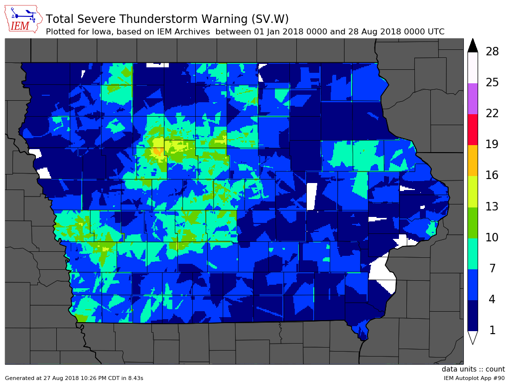
Thunderstorms impacted Iowa on Sunday and again on Monday with an encore expected
on Tuesday. Some of these storms warranted warnings, which are issued by the National
Weather Service for distinct spatial polygon regions (called Storm Based Warnings). The
featured map presents an accounting of the number of warnings per location in the state
(discretized on a 1/100 of a degree grid). The locations in white are indicated to have
gotten zero Severe Thunderstorm Warnings so far this year. The most active location on
this map is northeastern Calhoun County. You can generate maps like this on the website
for other locations, times, and severe phenomena of your choice!
Voting:
Good = 12
Bad = 0
Tags: 2018 warnings
Voting:
Good = 12
Bad = 0
Tags: 2018 warnings