Rain Shield
Posted:
Iowa's glorious most recent weekend was thanks to a strong high pressure system to our
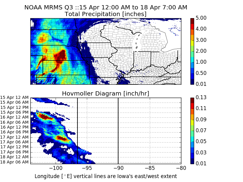
east that kept storms over the High Plains at bay. The featured chart displays NOAA
MRMS precipitation estimates from Friday through Monday morning. The top panel is a
simple map of precipitation totals showing the heavy amounts over Nebraska and South
Dakota. The bottom panel is a Hovmoller diagram showing a time series of meridional
averaged hourly precipitation over the domain shown in the top panel. This type of plot
has some neat attributes as it shows the east/west progression of storms with time and with
the east/west domain of Iowa shown, you can see how the areas of precipitation struggled
to move east with time. Rain eventually did make into Iowa on Monday with totals mostly
below an inch.
Voting:
Good = 10
Bad = 0
Tags: hovmoller
Voting:
Good = 10
Bad = 0
Tags: hovmoller
