IEM Daily Feature
Friday, 26 May 2023
Friday, 26 May 2023
SVR + TOR Warning Ranks
Posted: 26 May 2023 05:30 AM
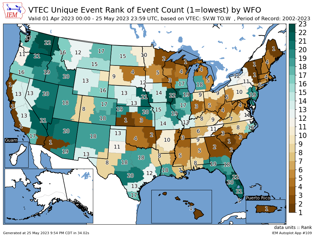
The featured map is an unofficial attempt by the IEM to rank the total number of severe thunderstorm
and tornado warnings issued since 1 April this year vs each year since 2002 by NWS Office. With 22
years of record, a value of 22 would indicate the highest total over this period of days. This map shows
a lot of variability, but some regional signals can be seen. For Iowa, Davenport ranks at the top and
Omaha with the second highest total for each respective office. La Crosse, WI is at the other end with
the third lowest total. While severe weather is not desired at any point in the year, they are coincident
with thunderstorms and storm complexes that often bring needed rainfall. The present forecast
continues to be very dry with perhaps our first chance of storms returning late into next week.
Voting:
Good = 12
Bad = 1
Abstain = 2
Voting:
Good = 12
Bad = 1
Abstain = 2