IEM Daily Feature
Tuesday, 29 October 2019
Tuesday, 29 October 2019
First Trace of Snowfall
Posted: 29 Oct 2019 05:35 AM
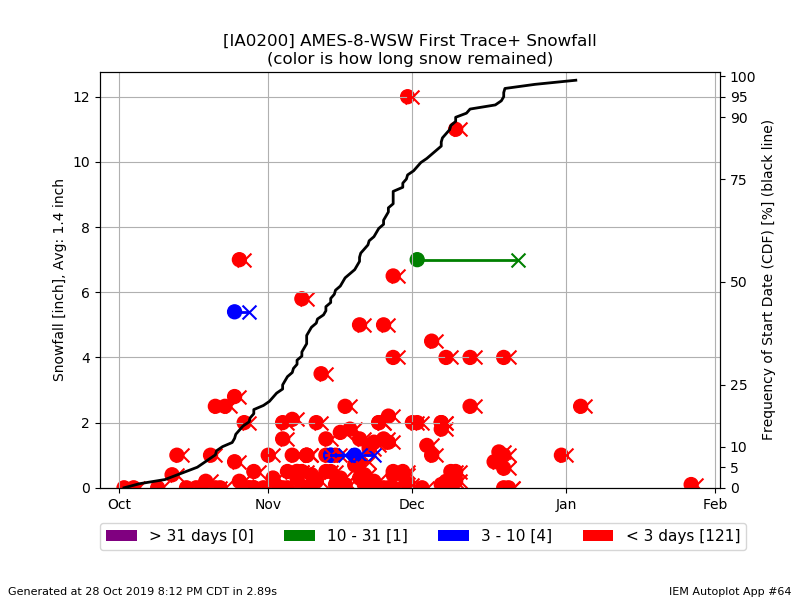
The first round of snowfall fell overnight with very light totals over the state. So it is likely a good time
to check in on if having the first trace of snowfall is early or not. The featured chart presents the date
of the first trace or higher snowfall for Ames, the number of days that snow stuck around, and the
accumulated frequency of having such an event by the given date. The chart nicely shows that this
first snowfall almost always does not stick around long. This is due to soil temperatures which are
still generally above freezing this time of year and will work to melt any snow that falls. The next
round of snow arrives tomorrow and will primarily impact southeastern Iowa with higher amounts of
snow than what fell with this first round.
Voting:
Good = 11
Bad = 1
Tags: snow
Voting:
Good = 11
Bad = 1
Tags: snow